Find any Amazon.com product's deals and best prices with our free Amazon deal finder and price tracker. Simply paste the product link (URL) or search by name in the box above. You'll get full product information, Deal Score, and all current deals. Shop smarter with the best Amazon deals finder in the USA.
x
Sorry, Something went wrong!
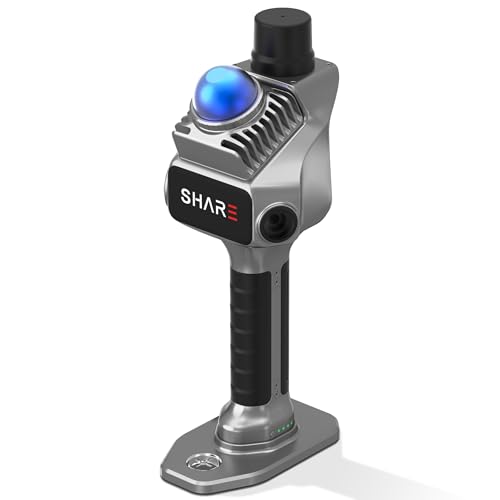
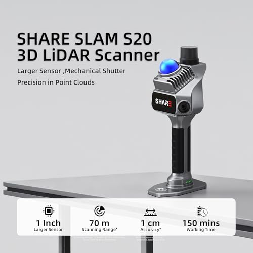

SHARE SLAM S20 Handheld 3D LiDAR Scanner - Professional Spatial Mapping Camera for Surveying & Architecture | 1cm Relative Accuracy, 70m Range, Dual 1-Inch Sensor | True-Color Point Cloud & 3DGS Ready
✅ In stock
F
Grade
⚠️ Price may have changed. Last updated 24+ hours ago — confirm on Amazon.
Check Deal at Amazon
Price verified Nov 5, 2026 10:27 PM · Prices & availability subject to change
Is This a Good Price on Amazon?
💤 Not a Deal- 💤Verdict: Not a Deal. Price is at or above historical norms. Best to wait for a sale.
- ➡️Pricing has held fairly steady, with no strong push in either direction.
How We Scored This Deal
Price Competitiveness
0/28
Recent Value
0/22
Market Standing
0/20
Deal Strength
0/20
Momentum
0/10
📝 Product Overview
🏪 Sold by
SHARE3DCAM_official
📦 Fulfillment
Fulfilled by Amazon
🚚 Shipping
Free Shipping
Product Details
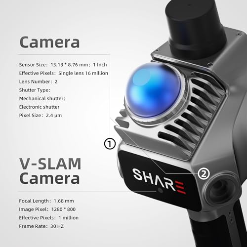
✓1cm High-Precision & 70m Long-Range Scanning: Engineered for demanding terrain and architectural surveying. Equipped with dual 1-inch large-area CMOS sensors delivering 16MP resolution per lens (2.4μm pixel size). It reliably captures spatial data from 0.1 to 40 meters (@ 10% reflectivity) and up to 70 meters (@ 80% reflectivity) for highly accurate 3D mapping.
✓360° LiDAR FOV & Distortion-Free Modeling: Rapidly scan large-area indoor and outdoor spaces in minutes with an expansive 360° × 59° field of view. The built-in mechanical shutter effectively eliminates motion distortion (rolling shutter effect), while dual 16MP ultra-wide cameras (32MP combined) ensure flawless close-range photogrammetry and precise object modeling.
✓True-Color Point Cloud with Hardware Sync: Ideal for professional VFX, CGI, and digital twin workflows. Microsecond-level system-wide hardware synchronization ensures perfect alignment of real color and intensity. Combined with global shutter technology, it guarantees the seamless integration of rich color data into highly accurate point clouds.
✓Open Algorithm & 3D Gaussian Splatting (3DGS): Designed for advanced, industry-specific pipelines. The system provides raw data accessibility to support custom SLAM algorithm integration, and optimized 3D Gaussian Splatting (3DGS) workflows using precise image pose metadata.
✓Complete Software Ecosystem & Multi-Format Export: SHARE Capture and SHARE PointClouds Studio are included for SHARE3DCAM users at no additional software license cost. Preview point clouds in real time on mobile, then process, review, measure, and crop project data on desktop. Export point clouds in PLY, LAS, PCD, E57, and RCS formats, and export CAD floor plan and section drafts as DWG files for downstream CAD and BIM workflows.
✓Package Contents: SHARE SLAM S20 LiDAR Scanner*1 PC,Grip Battery*1 PC,Charger*1 PC,Position Plate*1 PC,Card Reader*1 PC,Wipe Cloth*2 PCS,Warranty Card*1 PC,User Manual*1 PC,Data Cable*1 PC,Phone Holder*1 PC,one-year warranty, and professional technical engineer support.
✓SHARE PointClouds Studio v2.7.0 – Enhanced 3DGS & New Mesh Generation: Create 3D Gaussian Splatting scenes for immersive viewing, and use the newly added mesh generation feature to turn point cloud data into 3D mesh models. Export mesh models in 3D Tiles, OSGB, GLB, and PLY formats for visualization and downstream 3D workflows in compatible software. Process and export color point clouds to support measurement and CAD/BIM preparation, turning captured spaces into practical project deliverables.
⚙️ Specifications
14.21 x 12.09 x 11.69 inches
8.71 pounds
SHAREUAV Ltd.
B0G1B927V5
1 Lithium Metal batteries required. (included)
October 20, 2025
Package Dimensions
14.37 x 12.2 x 11.3 inches
Item Weight
9.35 pounds
Manufacturer
SHAREUAV Ltd.
ASIN
B0G1B927V5
Batteries
1 Lithium Metal batteries required. (included)
Date First Available
October 20, 2025
Best Sellers Rank
See Top 100 in Industrial & Scientific
Ships From
Amazon