Find any Amazon.com product's deals and best prices with our free Amazon deal finder and price tracker. Simply paste the product link (URL) or search by name in the box above. You'll get full product information, Deal Score, and all current deals. Shop smarter with the best Amazon deals finder in the USA.
x
Sorry, Something went wrong!
🔥 HOT DEAL

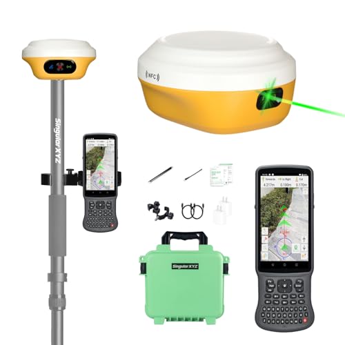

L1-Laser GNSS RTK Rover – Laser + GNSS, Handheld Collector with Software & AR Stakeout, 2cm Accuracy, 15km UHF, 120° Tilt Survey | Self-Developed Factory & Professional Support
✅ In stock
📉 Price recently dropped
B
Grade
Analysis Confidence
100%
Price verified Nov 13, 2026 5:11 PM · Prices & availability subject to change
Is This a Good Price on Amazon?
👍 Good Deal- 👍Verdict: Good Deal. Solid value. Price is noticeably below the recent average.
- 💰The current price is 64% below what this product typically costs — a notable saving over its usual going rate.
- 📉Better-priced windows have occurred before, though not frequently — today's price is reasonably competitive.
- ➡️Pricing has held fairly steady, with no strong push in either direction.
How We Scored This Deal
Price Competitiveness
28/28
Recent Value
22/22
Market Standing
14.6/20
Deal Strength
0/20
Momentum
4/10
📝 Product Overview
🏪 Sold by
SingularXYZ
📦 Fulfillment
Fulfilled by Amazon
🚚 Shipping
Free Shipping
Product Details
✓【Centimeter RTK Performance】L1-Laser GNSS RTK support with1408-channel L1/L2 GNSS engine delivers 5-second initialization and centimeter accuracy under trees and urban canyons, supporting GPS/GLONASS/Galileo/BDS/QZSS/SBAS.
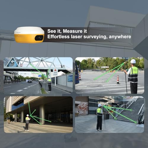
✓【Laser + GNSS Hybrid Survey】Our L1-Laser gps rtk has Integrated laser enables 10m non-contact measurement for inaccessible points such as powerlines and bridge edges while maintaining centimeter precision.
✓【120° Tilt Compensation】High-grade IMU supports ±60° tilt with auto-calibration, achieving 2cm accuracy at maximum tilt for faster, pole-free topographic surveys.
✓【15km UHF Radio】The L1 gps surveying equipment built-in 2W UHF transceiver provides up to 15km rover-base range and supports RTCM/CMR, compatible with third-party bases and CORS/NTRIP workflows.
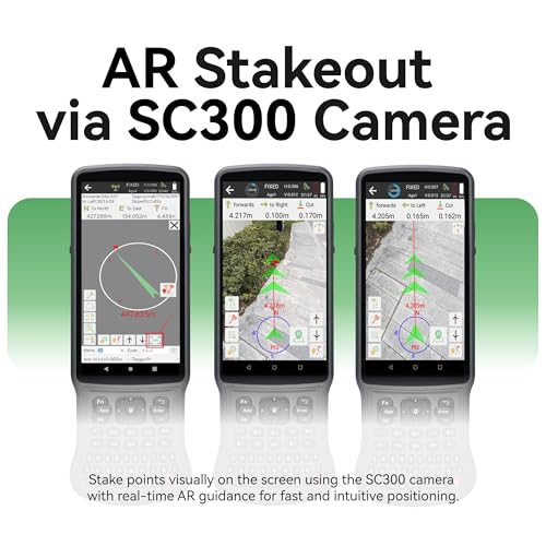
✓【AR Stakeout】Paired with the handheld collector, SingularPad enables AR stakeout—overlaying virtual point guidance on the camera view for faster, intuitive field layout.
✓【ABOUT US】SingularXYZ focuses on high precision GNSS PNT (Positioning, Navigation & Timing) technology, extending its coverage to geospatial information, precision agriculture, machine control, robotics, telecom, IoT and etc., providing reliable, stable and professional products and service, committed to popularizing precision and intelligence into all aspects of people's lives, contributing to the construction of an informatized, intelligent and efficient world.
✓【Note】U.S. users must apply for an FCC radio license for commercial use (e.g., surveying, construction) with the UHF function (450–470 MHz). The device is FCC certified, and we can provide supporting info if needed. The rtk gps equipment does not include the pole.
✓CLASS 3R LASER SAFETY: L1 LASER features a Class 3R laser module with 4mW maximum output power and 520nm±20nm wavelength. Designed for professional surveying positioning assistance only. Please follow the safety instructions during operation.
⚙️ Specifications
Brand
SingularXYZ
Model Name
L1-Laser rover gnss rtk
Vehicle Service Type
Bus
Screen Size
1 inches
Special Feature
Bluetooth, Touchscreen, Waterproof
Connectivity Technology
Bluetooth, Ethernet, USB, Wi-Fi
Map Type
Worldwide
Included Components
L1 GNSS Receiver, Transport Case*1, USB-Type C Cable*2, Super Charger*2, Whip Antenna*1, GNSS Adapter*1 SC300 Data Collector*1, Bracket*1, SingularPad Software*1 Quick Start Guide*1, Quick Start Card*1
Audio Output Mode
Digital
Battery Life
12 hours
Item Weight
1.2 pounds